Radar and Satellite Tile API
The Radar and Satellite Tile API is a raster tile API, which can be used with all common mapping libraries.
Basic URL
https://maps-api.meteoblue.com/v1/tiles/{tileset}/{date-value}/{z}/{x}/{y}.{extension}?{get-parameter}
Parameters:
| Attribute | Type | Description |
|---|---|---|
tileset | string | The name of the requested tileset. See below for a list of available tilesets. |
date-value | string | Time information as gained from the time API. |
z, x and y | number | The coordinates of the tile. Usually those parameters are set by the used mapping library. |
extension | string | Each tileset is available in at least one file format. See the list available tilesets for details. |
Available tilesets
| Layer | tileset | Description | extensions | Example |
|---|---|---|---|---|
| Global satellite | satellite_global | Global satellite image without forecast | jpg | 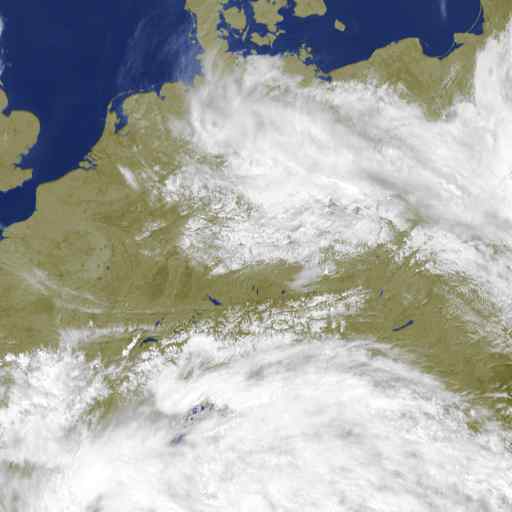 |
| Global precipitation | precipitation_global | Global radar image without forecast | png | 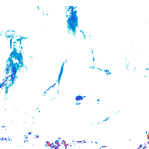 |
| Europe radar | radar_eup | Radar image for Europe with 2 hours forecast | png | 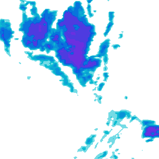 |
| US radar | radar_us | Radar image for the Unites States with 1 hour forecast | png | 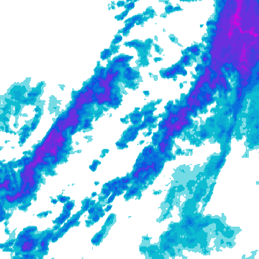 |
Not all areas which are covered by radar on the meteoblue website and mobile apps are available in this API. For areas without ground observed radar data, precipitation data from satellites is used instead. This data is usually less precise than radar data.
The maximum zoom level for all radar and satellite tiles is 6.
Date (date-value)
Radar and satellite images are not always available at regular intervals. To accommodate this, meteoblue provides information about available time steps. Please refer to the timesteps section in the Time API documentation.
First fetch the information about available timesteps from the Time API
and use the corresponding value from the response in the tile request,
like in this example.
The Satellite and Radar Tile API does not use dates directly.
The date value has to be taken from the time API.
The format of {date-value} can change at any time!
GET parameters
| GET parameter | Type | Default | Description |
|---|---|---|---|
| apikey | String | none | API key obtained from meteoblue |
Examples
Find some basic examples for integration with Leaflet and Mapbox GL JS on the examples page.